April 22, 2006
New York City
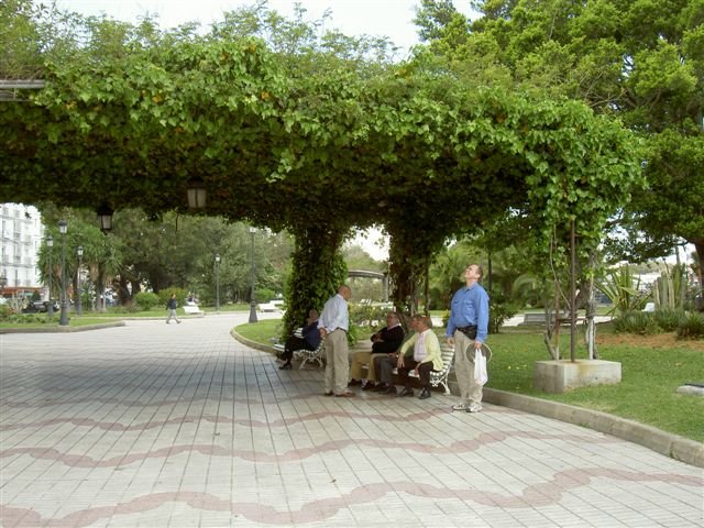
New York City is the largest city in the United States, the home of the United Nations, and the center of global finance, communications, and business. New York City is unusual among cities because of its high residential density, its extraordinarily diverse population, its hundreds of tall office and apartment buildings, its thriving central business district, its extensive public transportation system, and its more than 400 distinct neighborhoods. The city’s concert houses, museums, galleries, and theaters constitute an ensemble of cultural richness rivaled by few cities. In 2000 the population of the city of New York was 8,008,278; the population of the metropolitan region was 21,199,865. Before Europeans came to the place now known as New York City, it had been the home of Native Americans of the Algonquian language group. Literally hundreds of these self-governing bands lived along the East Coast from North Carolina to Canada. At least 18 of these bands lived in the New York City area. The Canarsees, who were especially prominent in what is now Brooklyn, had settlements in present-day Gowanus, Sheepshead Bay, Flatlands, and Canarsie. Although these local groups were not as advanced as the Maya, Inca, or Aztecs, who lived farther south in the western hemisphere, they lived in peace with nature and with each other. They constructed long bark houses, replete with thatched domes, of substantial size, and they planted wheat, maize, beans, and squash. Many modern roads, such as Flatbush Avenue and Kings Highway, follow the route of paths that connected the various Native American villages.
Colonial Period
In 1524 Giovanni da Verrazzano, an Italian in the employ of France, became the first white man known to have sailed up the narrows into the lower bay. In 1609 the English navigator Henry Hudson, who had been hired by the Dutch East India Company to search for a water route through North America to Asia, arrived in New York harbor aboard his 74-foot ship, The Half Moon.
Dutch Rule
Hudson discovered that the vast area between French Canada and British Virginia was unfortified and unclaimed and that the Native Americans who lived at the mouth of the Hudson River would happily trade furs for European goods. Excited by the commercial prospects of Manhattan Island, which was in the midst of a vast harbor that was ice-free in all seasons, Dutch merchants promptly dispatched other expeditions to the vicinity. The Dutch East India Company established the first permanent European settlement in what is now New York City in 1624. Although most of the Dutch settlers established themselves in the northern Hudson Valley, near the future site of Albany, about eight or ten Protestants from Belgium, who had taken refuge with the Dutch to escape religious persecution, settled on Governors Island in New York harbor. In 1625 the tiny community moved to the southern tip of Manhattan Island. A year later, according to legend, Dutch colonial governor Peter Minuit purchased Manhattan from the Canarsees for 60 guilders (approximately $24) in trinkets and goods. The city of New Amsterdam, as it was soon called, operated as part of the colony administered by the Dutch West India Company.
From the Navigator
We will continue sailing north-northeast along the east coast of the U.S. through the Atlantic Ocean. We begin to loose the effects of the Gulf Stream as we round Cape Hatteras, North Carolina, early in the morning. During the night we will enter the Barngat to Ambrose traffic lane, a shipping lane, like lanes of the road that ships must follow. We will follow this shipping lane throughout the night as we sail towards New York.
April 21, 2006
The Earth’s Atmosphere
The earth’s atmosphere is composed of distinct layers. The troposphere extends upward from the earth to a height of about 5 miles (8.1 kilometers) at the poles, to about 7 miles (11.3 kilometers) in mid-latitudes, and to about 10 miles (16.1 kilometers) at the equator. The air in the troposphere is in constant motion, with both horizontal and vertical air currents. Throughout the troposphere, temperature decreases with altitude. Above the troposphere is an atmospheric ozone layer, which is also the lower layer of the stratosphere. Temperature changes little with altitude in the stratosphere, which extends upward to about 30 miles (50 kilometers). Above this layer is the mesosphere, which extends to about 50 miles (80 kilometers) above the earth; the temperature sharply decreases at the base of the mesosphere before it begins to rise at the top of the mesosphere. The next layer is the thermosphere, which extends upward from the mesosphere to about 400 miles (640 kilometers); its temperature increases rapidly with altitude because of the absorption of shortwave radiation by ionization processes, although, because of the thinness of the air, little heat energy is available. The final layer is the exosphere, which gradually gets thinner as it reaches into the vacuum of space at around 435 miles (700 kilometers); the atmosphere is so attenuated at this altitude that the average distance air molecules travel without colliding is equal to the radius of the earth.
Atlantic Ocean History
• In 1858, the first transatlantic telegraph cable was laid by Cyrus Field.
• In 1919, the American NC-4 became the first airplane to cross the Atlantic (though it made a couple landings on islands along the way).
• Later in 1919, a British airplane piloted by Alcock and Brown made the first non-stop transatlantic flight from Newfoundland to Ireland.
• In 1921, the British were the first to cross the North Atlantic in an airship.
• In 1922, the Portuguese were the first to cross the South Atlantic in an airship.
• The first transatlantic telephone call was made on January 7, 1927.
• In 1927, Charles Lindbergh made the first solo non-stop transatlantic flight in an airplane (between New York City and Paris).
• After rowing for 81 days and 2,962 miles, on December 3, 1999, Tori Murden became the first woman to cross the Atlantic Ocean by rowboat alone when she reached Guadeloupe from the Canary Islands.
From the Navigator
We will sail northeast on the North Atlantic Ocean along the east coast of the US, following the Gulf Stream from Florida up to North Carolina. The Gulf Stream is of great climatological importance because of its moderating effects on the climate of western Europe.
April 20, 2006
Welcome to Fort Lauderdale, Florida
Fort Lauderdale is a city in southeastern Florida and seat of Broward County. The city is located where the New River enters the Atlantic Ocean. Fort Lauderdale is a major yachting center and a beach and fishing resort. Called the Venice of America, the city has an extensive network of inlets and canals that, with the New River, provides more than 165 miles, 266 kilometers, of navigable waterways. These waterways include a portion of the Intracoastal Waterway that passes through the city. The city’s nearby artificial harbor, Port Everglades, has the deepest water of any port on the United States Atlantic coast south of Norfolk, Virginia. Fort Lauderdale’s beaches draw visitors from around the world, and tourism is a leading contributor to the economy. South Beach has a promenade of wide walkways for enjoyment of the city’s climate. The city is served by Fort Lauderdale-Hollywood International Airport. Florida, sometimes called the Peninsula State, consists of a large low-lying peninsula and, in the northwest, a strip of land known as the panhandle. It is a region of low, rolling hills, vast swamps and marshes, numerous lakes, and extensive forests. Superimposed on this varied pattern of physical features are the farmlands, urban areas, transportation routes, and other cultural features that have transformed Florida from largely a wilderness area into one of the fastest-growing states in the Union.
Early Inhabitants of Florida
There were an estimated 350,000 Native Americans in what is now Florida when Europeans first arrived early in the 16th century. They belonged to three major nations: the Calusa along the southwestern coast, the Timucua in the northern half of the peninsula, and the Apalachee where the peninsula joins the panhandle. Peoples dominated by the Calusa lived along the southeastern coast. They lived in villages, where they cultivated corn, beans, and other crops. Noted warriors, they fiercely resisted early attempts to bring them under submission, but coexisted peacefully with the Spaniards for most of the first 198 years of Spanish occupation. Diseases introduced by the European explorers drastically reduced the populations of these Native Americans. They had no resistance to pathogens such as measles, smallpox, and typhoid fever that Europeans normally survived. The Native Americans also lost ground because of slaving raids by English forces from South Carolina and Georgia. By mid-18th century these nations no longer existed. The modern Native Americans of Florida are the Seminole, originally Creek from the Georgia-Alabama border, who entered Florida in the period 1716 to 1767. Today they have five reservations in the state.
April 19, 2006
Coming Full Circle…
It hardly seems possible that this truly grand Grand World Voyage is coming to an end and that we must say farewell. With excitement and anticipation we welcomed most of you to this glorious vessel on January 5 in Fort Lauderdale. Before we knew it, Captain Gundersen and his fine crew were sailing us safely from one wonder of the world to the next. From rhythmic Rio to icy Antarctica; from islands remote and mysterious to harbors almost too beautiful to describe; from awe-inspiring Africa to the splendor of India; and from the Suez Canal to the day we lost the sun in a glorious total eclipse; to the magic of the Mediterranean and finally across the Atlantic towards home. For those of us who live and work onboard the ms Prinsendam, this is our home away from home and you have become our “family away from our family”. Although it is difficult to say farewell to those we have shared so many extraordinary moments with, we say it knowing that this cruise was completely unique. Never before or again will this “recipe” come together to create such a delicious masterpiece of adventure. Take one beautiful ship, add 35 ports of call, 189,000 meals (at least), 63 guest entertainers, 18 lecturers, 2 guest chefs, 3 production casts, 27 folkloric, welcome or farewell shows, dashes of Tai Chi, Bridge, Dance Instruction, Arts & Crafts and Watercolors, equal parts of spirituality, 2500 trivia questions, 18 musicians, the highest quality Hostess and Cruise Staff, one superb Captain and Hotel Manager, unique ingredients contributed by 450 crew and that special “secret ingredient” and what you get is the best Grand World Voyage ever. What is that “secret ingredient”? You. You have been the most gracious, generous, fun, active and involved guests I have had the pleasure of sailing with on 11 World Cruises. Thank you for the privilege of being your Cruise Director and for providing me with a world full of memories. Our “Circle of the Sun” voyage has come full circle and we can all bask in the warm rays of golden memories that we will all cherish forever.
Personal Musings April 12-17, 2006
April 12, 2006 Funchal, Madeira, Portugal
I had always read about Madeira and only knew that it was famous for wonderful embroidery and fortified wine. What a nice surprise to find a charming island with white houses with red adobe roofs. Alemitu went on a shore excursion that had been donated to Carter and I went off to explore the island on my own. Carter had to work for the morning. The weather was perfect, cool and sunny, warming as the day matured. The people were friendly, each sidewalk had a different pattern, based on the street. This is a volcanic island, so there is plenty of black lava for decoration.
Then in the afternoon, Carter and I headed off with the personal trainer and we took the cable car up to the top of the island. I didn’t see much since I had my eyes closed most of the time. Then there is an island tradition of riding a wicker basket down the steep streets, with two runners controlling the descent. Again, terror set in for me. Carter and Allison shrieked and laughed while I bore my terror in silence. I did almost wrench Carter’s anterior leg off, as I held on for dear life.
The wicker ride only took us half way down the hill, so we had quite a hike to get to the bottom. All in all, we walked over 8 miles today, but the final jaunt was so nice, giving us a chance to enjoy the personal gardens of the people of Funchal, to marvel at the fact that they often had vineyards right within their gardens. We returned to the ship tired but having a great place to visit in the future.
April 14, 2006 At sea in the Atlantic
Well, we truly know that we are on the way home. We look at all that we have accumulated and wonder where it will all be put – how much will we have to pay in excess baggage? We are also looking at our lives as we return to real life. What have we missed, and what will be getting more attention? Pretty heavy stuff.
One passenger announced that she had already packed 10 suitcases and still had an entire rack of clothes to go. She was so relieved when the cabin steward presented her with 3 bags that she had forgotten about and placed in storage when she arrived……I don’t think I have 13 bags of clothes to my name, much less on the ship!
April 16, 2006 At sea in the Atlantic
On the early morning of April 15, Carter was called because a crew member was suffering from abdominal pain. It ended up being one of those horrible situations where the young man has appendicitis and we are 2 ½ days from land, either way we go. It has been interesting to see the reaction of the ship’s passengers and crew. Some people are interested only as to whether this will impact their travel plans, never a word about the poor crew member. And, of course, there is the other side of the equation. Less than 4 hours from the first call, there was a passenger, asking us about the young man by name, wishing him well, concern written on her face. We didn’t know that anyone knew, but word travels quickly. So Alemitu and I have learned to not disclose any information, but to still be polite and respectful. She has been to see the young man several times since she and he would joke around most days. All of the religious groups on board have added him to their prayers, while the captain has changed the course of the ship to make an emergency landing in Bermuda as soon as we can reach it. At this moment he is doing well. We can only wait and see. Not something I am too good with.
April 17, 2006 At sea in the Atlantic
So far, so good. The young man is stable, not getting worse.
April 18, 2006
Cruise Director Bruce Allen Scudder
A native “Michigander”, Bruce’s winning appearance on a television talent show at the age of 7 led to TV commercials, radio and print ads, and public appearances all over the USA billed as “Little Brucie Scudder”. After graduating from the University of Michigan with a degree in piano performance, Bruce earned a double masters degree in piano performance and conducting from the Juilliard School in New York. He has worked in virtually every area of show business as a music director and pianist, conducting for and accompanying dozens of the world’s best entertainers. Bruce began his career with Holland America Line in 1992 as Music Director and is proud to have served on 11 Grand World Voyages – 9 as Music Director and 2 as Cruise Director. This year he celebrates his 14th year with Holland America Line. Bruce says, “Holland America does it so well. They truly care about the safety and comfort of their guests, and as Cruise Director, I am proud to offer our excellent variety of entertainment, lectures, activities, religious and supplemental services.” Bruce makes his home in Jacksonville, Florida where he has an extensive collection of art and antiques, including a stunning display of glassware from the estates of celebrities from the “golden age of Hollywood”. Bruce is a skydiving enthusiast, jumping from perfectly good airplanes at 14,000 feet with a 10,000 foot freefall!
From the Navigator
In 1537, Flemish mapmaker Geradus Mercator designed a map specifically for navigation. A Mercator map reflects the curvature of Earth. But a map is flat and the earth is spherical, so while the equatorial regions appear normal on the map, the high latitudes are greatly distorted. Any line cutting two or more meridians at the same angle is represented on a Mercator map as a straight line. Such a line, called a rhumb line, represents the path of a ship following a steady compass course. Charts and maps continued to become more accurate and detailed, and by 1700, charts included compass variation and ocean currents. In the 19th century, portrayal of the sea bottom’s geographic features on charts became more accurate. Hydrographic survey ships’ reports, combined with data sent by merchant and naval vessels, became the authorities for sailing instructions and new charts. Today, much of the data used to make charts is collected with electronic instruments. Satellites, echo sounders, and sonar devices survey land and take soundings with unprecedented precision, often finding rocks, wrecks, and shoals that the old methods had missed altogether.
April 17, 2006
Social Hostess Christine Dubus
Coming from Melbourne, Australia, Christine first joined the Holland America Line fleet seven years ago where she combined her background in retail, tourism and dance to travel the world. After completing her education Christine spent time modeling and doing promotional work for major corporations. Living in France for 2 years she continued her modeling and dance career and she learned how to make a crepe or two! Returning to Australia, she qualified as a massage therapist and ran a dance school for children and teenagers, touring the local community with her performances. Christine changed directions and quickly moved into the manager’s position of a major clothes and gifts retail store where she stayed for 5 years. Leaving retail behind, she worked as Hostess with one of Australia’s leading touring companies, and now finds her position onboard as Hostess to be a dream come true! Hosting coffee chats, the culinary arts center, social events and meeting the guests onboard is always a pleasure for her as she enjoys constantly broadening her horizons and hearing the stories that the guests have to share. Christine loves the sun and enjoys new experiences! When not at work, she has an interest in Quantum physics, philosophy, dancing, cooking exotic food, reading and of course relaxing on a beach. Having traveled to all seven continents, Christine shares her love of life with all she meets and is enjoying being a part of this very memorable cruise, truly an adventure of a lifetime!
From the Navigator
The cooling of air as it rises produces most clouds and almost all precipitation. When air temperature is reduced, excess water vapor in the air condenses into liquid droplets or ice crystals to form clouds or fog. A cloud can take any of several different forms, including cumulus, cirrus, and stratus, reflecting the pattern of air motions that formed it.
April 16, 2006
Happy Easter
Easter is celebrated on a Sunday on varying dates between March 22 and April 25 and is called a ‘moveable feast’. Connected with the observance of Easter are the 40-day penitential season of Lent (beginning on Ash Wednesday and concluding at midnight on Holy Saturday, the day before Easter Sunday), Holy Week (commencing on Palm Sunday, including Good Friday, the day of the crucifixion, and terminating with Holy Saturday) and the Octave of Easter (extending from Easter Sunday through the following Sunday). During the Octave of Easter in early Christian times, the newly baptized wore white garments, white being the liturgical color of Easter and signifying light, purity, and joy. Easter also embodies many pre-Christian traditions. The Christian festival of Easter probably embodies a number of converging traditions; most scholars emphasize the original relation of Easter to the Jewish festival of Passover, or Pesach, from which is derived Pasch, another name for Easter. The origin of its name is unknown. Many scholars believe it probably comes from Eastre, the Anglo-Saxon name of a Teutonic goddess of spring and fertility. Her festival was celebrated on the day of the vernal equinox; traditions associated with the festival continue today with the Easter rabbit, a symbol of fertility, and in the coloring of eggs with bright colors to represent the sunlight of spring, and used in Easter-egg rolling contests or given as gifts. During the Presidency of Rutherford B. Hayes (1877 - 1881), it was Mrs. Hayes who originated the custom of inviting children for egg rolling at Easter on the White House lawn.
From the navigator
Accurate speedometers came into popular use in the latter half of the 19th century. Until this time, most sailors estimated their speed with a chip log, a float affixed to a rope knotted at intervals of 47.25 feet (14.4 meters). Navigators threw the float off the boat and counted the knots as they hit the water. The navigators timed their count, using a 28-second sandglass to ensure consistency. The number of knots that ran out in 28 seconds equaled the boat’s speed in nautical miles. The term knot, meaning one nautical mile per hour, originated with the chip log. If the first knot appeared as the sand ran out, the boat’s speed equaled one nautical mile per hour, or one knot. In 1861 English marine instrument maker Thomas Walker refined the patent log, and many sailors used this device to measure speed instead of the chip log. To measure speed using a patent log, a sailor counted the revolutions of a small rotor towed behind the ship’s stern.
April 15, 2006
The Assistant Cruise Directors
Born and raised in Canada’s beautiful capital, Ottawa, Benoit Gatien grew up on hockey rinks and baseball fields. Showing an early interest in archeology and travel, he left his first two years of university studies in accounting to complete a degree in Travel and Tourism. Working at sea has allowed him to fulfill several of his “must travel to” destinations. Traveling is now part of his lifestyle, much to the delight of his family and friends, who travel vicariously through him. Cynthia Corsine is from Brazil, where nuts come from! When she was 18, she moved to Seattle to study at the University of Washington, obtaining a certificate in Travel and Tourism and a Bachelor of Arts in Business Administration. After living in Seattle for six years, she joined Holland America Line in 2004. Cynthia loves traveling, cooking for friends and takes immense pleasure in tasting the food from different countries. Sometime soon she hopes to live abroad and obtain her Master’s Degree. Johnny Iglehart, a native of Chicago, has been fascinated with cruise ships since the age of five. After three months of working on board the Ryndam in 1998 on a summer break from Denison University in Granville, Ohio, Johnny was hooked on shipboard life. Since graduating in 1999 with a degree in Communication and Spanish, he has worked on ten of the thirteen ships in the fleet and is extremely honored to be here for his second Grand World Voyage. When not working you might find Johnny vacationing on the high seas with his parents!
Navigation
Radar is used for precise navigation when ships are near land and to detect the presence and movement of vessels and objects for navigation and collision avoidance. A radar instrument sends out a radio pulse through a rotating antenna, called a scanner. When the pulse hits a target, it bounces back to the scanner. The instrument calculates the time difference between transmission and reception. It converts this information into a visual display on a monitor, which shows the object as a point of light. The monitor displays the bearing to the target and the distance to it. This information can be used to quickly produce accurate positions and fixes. Radar is especially effective for detecting land and to indicate the presence and movement of vessels when out of the range of vision, or during times of restricted visibility in fog or haze.
April 14, 2006
Security Officer Henk Voskuilen
Henk was born and raised in Leusden the Netherlands. Just prior to starting his career within the Dutch Marine Corps, a small accident delayed his start. Determined on getting fit, Henk concentrated on practicing Jiu-Jitsu and Tea-Kwon-Do and exchanged the Marines for the Royal Dutch Marechaussee. He then had the opportunity to cover many different aspects the Organization had to offer especially assignments with multinational participation and often under awkward circumstances. From running Police Administrations during military exercises in Germany, participation in Anti-Riot Squads (Amsterdam), security for Euro-Top meetings, Immigration Services, escorts on behalf of the Department of Justice, Close Protection (Royal Family) to a more quiet role as an Instructor in order to share all the goodies and excitement with the new volunteers. Of a grand total of almost 15 years, 50% of his assignments have been abroad and therefore, Henk loves the “gypsy lifestyle”. Henk worked for 2-years as an International Police Supervisor for the MFO in the Middle East and was stationed in Rafah/Gaza. Returning home for only 3-weeks he was re-assigned to a Special Task Force in Dutch overseas Kingdom Territory. For the past 8-years Henk lives with his wife Alejandra and 2-year old daughter Renata in Mexico City and with whom he shares the passion for fine dining, good wine, traveling and painting. Instead of martial arts for exercise, Henk keeps fit by running after their daughter and getting her out of trees, closets, cabinets and anything with a handle.
From the Navigator (continued)
Air flowing in from seaward to replace this rising air forms the sea breeze, which under favorable conditions may set in well before midday, but often does not occur until the afternoon. At night the land cools much faster than the sea, hence the process is reversed, however land breeze at night is much weaker than the sea Breeze. The effects from land and sea breezes are usually confined to a distance of about 10 –20 nautical miles from the coast and is most noticeable in fair or fine conditions when the general winds over a larger area is light. Similar daily changes in temperature occur over irregular terrain and cause mountain and valley breezes. Other winds induced by local phenomena include whirlwinds and winds associated with thunderstorms.
April 13, 2006
Explorations Speaker Pat Pearson
Pat Pearson, MSSW is in the business of helping people develop their talents and abilities to the fullest. She travels the world sharing her ideas on personal development, offering proven methods for mobilizing individual resources to reach life goals. In her latest book, Stop Self-Sabotage! How to Get out of Your Own Way and Have an Extraordinary Life, Pat shows how to turn self-inflicted sabotage into positive action in order to reach goals, find happiness and be one’s best. Her earlier books include Passion: Reclaiming the Fire in Your Heart, in which she takes readers along seven steps designed to help them reclaim an exuberant zest for life, and You Deserve the Best, which offers a blueprint of increasing self esteem and self confidence. Informative and entertaining, Pat inspires her audiences with presentations that include personal stories and helpful psychological tips. A psychotherapist with more than 25 years experience as a clinical practitioner she now heads Pearson Presentations. She has received wide recognition for her own personal and professional accomplishments. Pat is a graduate of Southern Methodist University and received her Master’s degree in social work from the University of Texas at Arlington. She now lives in Southern California with her husband Steve and dog Guinness.
From the Navigator
On our west-southwest course through the North Atlantic, we will follow the north Equatorial current, providing us with an extra ¼ to 1 knot of speed; we also expect to have the wind in our favor, as we follow the northeast trade winds. Near the Equator is a low-pressure belt, known as the doldrums (sometimes called the Equatorial belt of calms) that lies roughly between latitudes 10° south and 10° north. This will cause the air to be hot and sultry.
Carter under the Grape Arbor in Cadiz

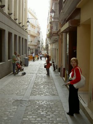
Winnie in the streets of Cadiz, Spain
April 12, 2006
Welcome to Funchal, Madeira, Portugal
Funchal is the capital of the Madeira Islands of Portugal and is also the largest city on the island. It was founded by Gonsalves Zarco in 1421 and was elevated to city by King Manuel I in 1508. The city is named after fennel, which grows on the island. Funchal is passed with a main road linking to both parts of the island and another road linking north to Faial and Santana. Part of Funchal Municipality is Ilhas Selvagens (Savage Islands and Desertas Islands), two beautiful nature reserve islands south of the city. In the early 1400s, Alvaro Fernandes was the commander of Funchal. And, in the 16th century, Funchal was important as a stopping place between the Indies and the New World, and was known as a wealthy place. Portugal, located on southwest Europe on the western Iberian Peninsula, includes the Madeira Islands and the Azores in the northern Atlantic Ocean. Originally inhabited by the Lusitanians, a Celtiberian people, the mainland area was subjugated by the Romans in the 2nd century BC and was later conquered by the Visigoths and Moors. Spain recognized Portugal as an independent kingdom in 1143, and it soon flourished as a maritime and colonial power with holdings stretching from Africa to the Far East and Brazil in the New World. Much of its empire was lost to the British and the Dutch in the 17th and 18th centuries, and the remaining colonies in Africa became independent in the 20th century.
Customs in Portugal
• Patience and persistence must be used when negotiating as well as small talk and pleasantries.
• Hands should be kept above the table rather than in the lap.
• It is rude to eat while walking down the street.
• Handshaking is the customary form of greeting.
• Conservative dress is encouraged.
Say it in Portuguese
Yes Sim
No Não
Thank you Obrigado
Please Por favor
Do you speak English? Fala ingles
Goodbye Adeus
April 11, 2006
Senior Assistant Cruise Director Steve Gayda
Steve was born on April Fools’ Day in Smiths Falls, Ontario, Canada, best known for being the Canadian home of the Hershey’s Chocolate Factory. He grew up in the Toronto and Ottawa areas and after graduating college with a degree in Tourism & Business, immediately moved back to Toronto and began working for Encore Cruises as an Inside Sales Representative. This gave Steve his first taste of the cruise industry. He was responsible for inside sales duties for Ontario, Alberta and British Columbia, as well as national brochure distribution and convention planning. While at Encore Cruises, Steve represented thirteen of the world’s finest cruise lines, including Cunard, Seabourn, and Holland America Line. He spent a great deal of time working with Holland America Line, including seminars and ship visits in Fort Lauderdale, and also sailing on the ms Amsterdam in New York City just prior to her official christening in late 2001. After almost three years behind a desk, Steve began working onboard for Holland America Line in late 2002. He has had the pleasure of working on seven ships in the fleet, and has held the position of Cruise Director on the ms Amsterdam and ms Oosterdam, and will continue in that capacity this summer on the ms Zuiderdam and ms Westerdam. Steve feels incredibly honored to have been selected for his second Grand World Voyage in 2006, and has enjoyed sharing a world of memories with all of you.
Personal Musings April 4-10, 2006
April 4, 2006 Catania, Sicily, Italy
Carter wasn’t feeling wonderful, so Alemitu and I took off to explore. We toured the local cathedral which was beautiful, but not as ornate as the one in Malta. Then we started searching for a FAX place. No one spoke English, so there was much pantomiming and broken English, but we were able to accomplish what we needed. We also, to Alemitu’s thrill, spent at least an hour in a fashionable clothing store where she went thru each item of clothing, trying on many of them. She only bought 2 items, but she was happy.
Then off to find something to eat, and not to eat on the main street. The traffic was scary with motorcycles driving on the sidewalks and cars careening down what I thought were pedestrian streets. We finally asked at some of the local places where they would eat for a true Sicilian meal. The restaurant they recommended was fantastic. Granted, I could probably have taken an extra Lipitor because of all the olive oil I consumed – but it was SO tasty.
April 5, 2006 Naples, Italy
This going from one port to the next in less than 24 hours is so disruptive. I finally figure out how to negotiate a place and we have to leave. Spending time in a place offers so much more exploration. If you make a false turn in this type of touring, you just chalk it up as a lost experience.
Italy is heading into an election, so the street is full of posters, leaflets and passion. Carter and I took off together, with Alemitu off with friends. We started walking and almost got killed by these crazy drivers. I get so nervous just crossing the street. Even a red light for the drivers is only a suggestion. Carter just doesn’t look at the drivers and walks. I hang on and close my eyes. We stopped at a tourist bureau and they suggested a great walking tour which we took off to accomplish. Unfortunately, all of the sites they suggested were either closed or under reconstruction. Even the obelisk they wanted us to see was covered with scaffolding and green plastic sheeting.
In general, Naples gave us a feeling of being SO crowded, confusing streets and many, many people. But every corner has a gorgeous statue or carving.
April 6, 2006 Rome, Italy
Alemitu took off very early this morning to go see the sites of Rome. She and her friend Cynthia, from Brazil, were given tickets on a bus to Rome, and then set up a walking tour that was more than ambitious. They were able to see everything they wanted, but returned exhausted!! I’ll let her describe her experience.
Carter and I stayed on the ship and had a family from Rome come for a visit. They had both worked at the Vatican in the archives section. He is a photographer and she was doing some of the translations there. We met them on a cruise to Alaska 12 years ago when they were on their honeymoon. Well, they now have 2 boys, ages 8 and 10 and we had a great time with having children around. We also had quite an interesting time discussing the Vatican library and the attempted modernization several years ago. It was great to get the story from the inside.
April 7, 2006 Corsica, France
Carter was up most of the night with a passenger and she handed him a cruise tour voucher because she decided that she would stay on board for the day. I didn’t know about it until about 20 minutes before the bus left, but I grabbed what was needed, and off I went. It was such a beautiful morning, cool, sunny, fresh. We saw some of the sites in town, but were able to travel out into the countryside and see where the people live and work in Corsica. What a charming island. I would love to come back here for a week of exploration. The history of this place is incredible. It is in the middle of the Mediterranean, such a desirable place over the ages. I think I also felt somewhat comfortable because I was able to speak and understand the language. They weren’t too friendly toward people who didn’t try to speak French.
April 8, 2006 Barcelona, Spain
Winnie and I took a two hour “Step On, Step Off” bus around the inner core of the city between 5pm and 8pm. We sat on open roof of the Blue Bus (chilly) and now we understand Ben’s raving about how beautiful this city is after a week here with friends. The commitment to creative art over the last 100 years is truly impressive. A beautiful harbor area, the remaining construction projects and infrastructure from the ’92 Olympics have left a lasting legacy for the very old and historic Spanish city. We ate a great lunch at a Turkish restaurant in a cellar which must have been 300 years old, then purchased some medical supplies for the ship at approximately 50% of our costs in the US. All in all, we really enjoyed our visit here and would love to return one day.
Carter
April 10, 2006 Cadiz, Spain
After a hectic morning Clinic for Carter which entailed an Emergency Disembark of a complicated multisystem failure patient, we took another open air bus trip about Cadiz.
Beautiful white sand beaches, narrow streets with huge wooden doors on the buildings, old fortresses dating back to Roman times, and gorgeous cathedrals and plazas were highlights. We loved the floral market and were tempted to buy shoes and dresses here. Stopped for hot chocolate at a local spot which has the consistency of warm and very thick and rich chocolate syrup….not what we were expecting. Made another run to a local pharmacy to replace inhalers, prednisone, and zithromax for the outbreak of RSV we are experiencing on board the ship….next stop Madeira, Funchal before heading across the Atlantic. Starting to dread the end of this trip!
Carter
April 10, 2006
Welcome to Cadiz, Spain
Cadiz is a coastal city in southwestern Spain in the region of Andalusia and the capital of the province of Cadiz. The Phoenicians originally founded the city as Gadir (walled city), who used it in their trade with Tartessos. The Greeks knew it as Gadira or Gadeira. Traditionally, its date of establishment is about 1100 BC, although as of 2004 no archeological finds have been found that date back further than the 9th century BC. One resolution of the discrepancy has been to assume that it was in the initial phase merely a small trading post. It is regarded as the most ancient extant city in western Europe. According to Greek legend, Heracles founded Gadir after killing Geryon. Indeed, one of its notable features during this era was the temple dedicated to the Phoenician god Melqart. Some historians think that the columns of this temple gave origin to the myth of the Columns of Hercules. In about 500 BC the city fell under the sway of Carthage. In 206 AD, the city fell to Roman forces under Scipio Africanus. Under the Romans it was renamed Gades. The city flourished under Roman rule, but with the decline of the Roman Empire, Gades’ commercial importance began to fade. Under Moorish rule, the city was called Qadis and the modern Spanish name Cadiz was derived from this form. cadiz port agent
During the Age of Exploration the city had another renaissance: Columbus sailed from Cadiz on his second voyage in 1495, and the city later became the homeport of the Spanish treasure fleet. Sir Francis Drake destroyed a Spanish fleet in the harbor of Cadiz in April 1587. In the Anglo-Spanish War, Admiral Robert Blake blockaded Cadiz from 1655-1657, during which one of his captains destroyed most of the Spanish treasure fleet. A galleon of treasure was captured and the overall loss to Spain was estimated at £2,000,000. In the 18th century, the city surpassed Seville as the port monopolizing commerce with Spanish America. Also, the Spanish Constitution of 1812 was proclaimed there.
Pre-spain’s History
The original people of the Iberian peninsula are named Iberians. In the 9th century BC, Celtic tribes entered the Iberian peninsula through the Pyrenees and settled throughout the peninsula, becoming the Celt-Iberians. The seafaring Phoenicians, Greeks and Carthaginians successively settled along the Mediterranean coast and founded trading colonies there over a period of several centuries. Around 1100 BC, Phoenician merchants founded the trading colony of Gadir or Gades (modern day Cadiz) near Tartessos. In the 8th century BC the first Greek colonies, such as Emporion, were founded along the Mediterranean coast on the East, leaving the south coast to the Phoenicians. The Greeks are responsible for the name Iberia, after the river Iber (Ebro in Spanish).
Spain’s History
Spain comprises mostly of the Iberian Peninsula and the Balearic and Canary Islands. Inhabited since the Stone Age, the region was colonized by Phoenicians and Greeks and later ruled by Carthage and Rome (after 201 BC). Barbarians first invaded Spain in 409 AD, but were supplanted by Moors from North Africa (711-719), who organized a kingdom known for its learning and splendor. The Moors were gradually displaced by small Christian states and were ousted from their last stronghold, Granada, in 1492. Ferdinand of Aragon and Isabella of Castile then became rulers of a united Spain, which became a world power through exploration and conquest. After the empire was lost in the 18th and 19th centuries, Spain experienced social and economic unrest that culminated in the Spanish Civil War (1936-1939) and the rise of Francisco Franco. After Franco’s death in 1975 the monarchy was restored under King Juan Carlos, who oversaw the creation of a parliamentary democracy.
April 8, 2006
Welcome to Barcelona, Spain
Barcelona is the capital of Catalonia, a region in northeastern Spain and the largest city in Spain after Madrid. It is located on the Mediterranean coast, between the mouths of the rivers Llobregat and Besos, south of the Pyrenees mountain range, the border with France. Legend attributes the Carthaginian foundation of Barcino to Hamilcar Barca, father of Hannibal. About 15 BC, Romans redrew the town as a castrum (a Roman military camp) centered on the Mons Taber, a little hill nearby the contemporary city hall. The Roman Colonia Julia Augusta Faventia Paterna Barcino was outshone by the province's capital Tarragona but some important Roman remains are exposed under the Plasa del Rei, entrance by the city museum, Museu d'Historia de la Ciutat and the typically Roman grid-planning is still visible today on the map of the historical center, the Barri Gotic (Gothic Quarter). Some remaining fragments of the Roman walls have been incorporated in the cathedral butted up against them; the basilica La Seu is credited to have been founded in 343. The Visigoths conquered the city in the early 5th century, by the Moors in the early 8th century, reconquered from the Emir in 801 by Charlemagne's son Louis who made Barcelona the seat of Carolingian Spanish Marches (Marca Hispanica), a buffer zone ruled by the Count of Barcelona. Barcelona was still a Christian frontier territory when Al-Mansur sacked it in 985. The counts of Barcelona became increasingly independent and expanded their territory to include all of Catalonia, later formed the Crown of Aragon who conquered many overseas possessions, ruling the western Mediterranean Sea with outlying territories as far as to Athens in the 13th century. The forging of a dynastic link between the Crown of Aragon and Castile marked the beginning of Barcelona's decline. This legacy exists to this day as evidenced by the fact that the city (and Catalonia as a whole) still has a substantial proportion of people whose first language is Castilian. The city was devastated after the Catalonian Republic of 1640 - 1652, and again during the War of the Spanish Succession in 1714. King Philip V of Spain demolished half of the merchants' quarter to build a military citadel as a way of both punishing and controlling the rebel city. During the 19th century, Barcelona grew with the industrial revolution and the introduction of many new industries. During a period of weaker control by the Madrid authorities, the medieval walls were torn down and the citadel of La Ribera was converted into an urban park. The beginning of the 20th century marked Barcelona's resurgence as Catalans clamored for political autonomy and greater freedom of cultural expression. Barcelona was a stronghold for the anarchist cause, siding with the Republic's democratically elected government during the Spanish Civil War. Franco’s forces overran it in 1939, which ushered in a reign of cultural and political repression that lasted decades. The protest movement of the 1970s and the demise of the dictatorship turned Barcelona into a centre of cultural vitality, enabling it to become the thriving city it is today.
Say it in Spanish
Yes Si
No No
Hello Hola
How do you do? Qué tal?
Goodbye Adiós
How are you? Cómo estás?
Thank you Gracias
Please Por favor
Sorry Perdón
How much is it? Cuánto es?
I don’t understand No comprendo
Customs in Spain
• Be prepared to wait although punctuality is appreciated.
• Small talk and pleasantries will be exchanged before negotiations will begin.
• Be friendly and personal even if the other party is reserved (which is normal).
• Handshaking is the customary greeting.
• Making the gesture of OK (holding your index finger to your thumb in a circle) is considered rude.
• Shorts are not considered acceptable dress.
barcelona, spain continued
April 7, 2006
Welcome to Ajaccio, Corsica, France
Ajaccio is a city and commune of France as well as the Capital of Corse-du-Sud. It is located on the west coast of the island of Corsica. It occupies a sheltered position at the foot of wooded hills on the northern shore of the Gulf of Ajaccio. The harbor lies to the east of the town and is protected on the south by a peninsula. The present town of Ajaccio lies about two miles (three kilometers) to the south of its original site, from which it was transferred by the Genoese in 1492. Occupied from 1553 to 1559 by the French, it again fell to the Genoese after the Treaty of Cateau-Cambrosis in the latter year. The town finally passed to the French in 1768. The peninsula carries the citadel and terminates in the Citadel jetty. To the southwest of this peninsula lies the Place Bonaparte, a quarter frequented chiefly by winter visitors attracted by the mild climate of the town. Apart from one or two fine thoroughfares converging on the Place Bonaparte, the streets are mean and narrow and the town has a deserted appearance. The house in which Napoleon I was born in 1769 is preserved, and street-names and statues everywhere emphasize his associations with the town. Ajaccio has a small manufacturing economy of cigars, macaroni, and similar products, and carries on shipbuilding, sardine-fishing and coral-fishing. Its exports include timber, citrons, skins, chestnuts and gallic acid.
Customs in France
• Although time is more relaxed than in America, be as punctual as possible.
• Negotiations may be formal and reserved rather than casual.
• Handshaking is the customary greeting and women usually initiate them.
• Do not crew gum in public.
Late History of Corsica
In World War II, Corsica was occupied by Italian and German troops. Late in 1943 the population revolted, and, joined by a Free French task force, drove Axis forces out. A postwar population exodus caused the French government to announce a program of economic development. In 1958 a right-wing coup, similar to that in Algeria, contributed to the return to power in France of Charles de Gaulle. In 2001, France’s parliament voted to give the island’s regional parliament power to amend some national legislation and regulations and to permit the Corsican language to be taught in schools, but the amending of national laws by regional parliaments was declared unconstitutional.
France’s Namesake
The name France comes from Medieval Latin Francia, which literally means land of the Franks. At the Treaty of Verdun in 843, the Frankish Empire was divided in three parts, and eventually only two: Francia Occidentalis (Western Frankland) and Francia Orientalis (Eastern Frankland). The rulers of Francia Orientalis, who soon claimed the imperial title and wanted to reunify the Frankish Empire, called their realm the Holy Roman Empire. The kings of Francia Occidentalis successfully opposed this claim, and managed to preserve Francia Occidentalis as an independent kingdom, distinct from the Holy Roman Empire. The Battle of Bouvines in 1214 marked the end of the efforts by the Holy Roman Empire to reunify the old Frankish Empire by conquering France. Since the name Francia Orientalis had disappeared, there arose the habit to refer to it as Francia only, from which the word France is derived.
April 6, 2006
Welcome to Civitavecchia, Italy
Civitavecchia is located in Latium, west central Italy, on the Tyrrhenian Sea. The harbor, favored by Trajan (early 2nd century AD), is still the chief port of Rome. It also handles traffic for the Terni industrial area and is the main maritime link with Sardinia. Industries produce metals, machinery, chemicals, and cement. Bernini built the Arsenal in Civitavecchia, and Michelangelo directed the final stages of the construction of the powerful citadel (begun 1508, nearly destroyed in World War II). Civitavecchia is only 37 miles (60 kilometers) northwest of Rome, the capital and largest city in Italy. Traditionally founded by Romulus in 753 BC, it was ruled first by Etruscans, who were overthrown 500 BC. The Roman Republic gradually extended its territory and expanded its influence, giving way to the Roman Empire during the reign of Augustus (27 BC to 14 AD). As capital of the empire, Rome was considered the center of the known world, but the city declined when Constantine transferred his capital to Byzantium in 323. Alaric I conquered the city in 410, leading to a lengthy period of devastation by barbarian tribes. In the Middle Ages the city revived as the spiritual and temporal power of the papacy increased. During the 1800s Rome was held at various times by the French until it became the capital of Italy in 1871.
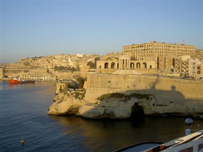
Valletta, Malta
April 3, 2006
Personal Musings; March 31-April 3
Later, March 31.
The last time we were in Crete, Carter was in the hospital with TB. I didn’t know how much I would remember of the city, but once we were walking around those windy little streets, with whitewashed buildings, it came back. We got a little lost, much to Alemitu’s annoyance, but we made it back to the ship in time. We were looking for the church that had 3 bombs dropped on it, but none of them exploded. After many wrong turns, as well as a good look at the local markets and residences, we found the church. I loved the orange and lemon trees with ripe fruit right in people’s little courtyards. We also bought one of the greasiest baklavas I have ever seen. Even though I didn’t eat it, I still got sticky just from holding it for a second.
A call to Ben brought the news that he and Mika are officially engaged. We couldn’t be happier.
April 1, 2006 Piraeus, Greece outside of Athens
Carter announced that he wasn’t going to be able to get off until around 2:30 in the afternoon, so Alemitu and I took off early for Athens. She was a little worried because I wasn’t exactly sure where I was going, but I was determined to make it to the Metro stop and find our way from there. We started walking and found that the usual instructions, “just 5 minutes walk” meant about 30 minutes, but we made it. The subway station is beautiful. Definitely an improvement since the Olympics. Alemitu was struck by the huge amount of graffiti present on all the buildings, both on the way to Athens, and within Athens. I truly hadn’t noticed it until she brought it up. Also, smoking is SO prevalent. Sort of sad.
We spent the day walking around the Acropolis, then walking around the town, shopping here and there, eating lunch at a sidewalk café. My meal, moussaka, was fantastic, but Alemitu’s was rather strange and not that tasty. We headed home on the Metro – a new stop, which we miraculously found – and just as we caught the shuttle bus, Carter was heading into town. We gave him some Euros and once at the terminal Alemitu met some friends and headed out again. I crashed while she had a second exploration of Athens. I’m sure it was a different view when traveling with kids her own age.
April 3, 2006 Valetta, Malta
What a charming city. The color is sandstone because the entire town is surrounded by a fort made with sandstone and then almost every building is also made of sandstone. When the wind picks up, you get sand in your eyes. The way from the port to the city is not for those walking challenged – steep hills, multiple flights of stone stairs – but the views are spectacular, the weather cool, with a breeze, but also plenty of sun. Who could ask for anything better. We took a tour of the famous St. John’s Co-Cathedral with the aid of an 86 year old guide. His English was heavily accented and I had to spend much of my time just trying to understand him, but it was so interesting and breathtaking. Some day Carter and I may come back here for a week, just to explore. It is a friendly place for those on foot.
April 5, 2006
Welcome to Naples, Italy
Naples is the largest city in southern Italy and the capital of the Campania Region. The city has a population of about 1 million, and together with its suburbs, the metropolitan area has 3.7 million inhabitants (Neapolitans). It is located just halfway between the Vesuvius volcano and another unrelated volcanic area, the Campi Flegrei. Inhabitants of the Greek colony of Cuma, around the 8th century BC, founded the city just a few miles from the more ancient town Partenope. For this reason it was named Neapolis (from Greek, meaning New City). Its buildings, museums and even the language spoken by natives bear traces of all periods of its history, from its Greek birth, until the present day. Although conquered by the Romans in the 4th century BC, it long retained its Greek culture. It was in Naples, in the Castel dell’Ovo (Castle of the Egg), that Romulus Augustus, the last Emperor of the Western Roman Empire, was imprisoned after being deposed in 476. In the 6th century, Naples was conquered by the Byzantines during the attempt of Justinian I to recreate the Roman Empire, and was one of the last duchies to fall in Norman hands in 1039, as they founded the Kingdom of Sicily. Frederick II Hohenstaufen founded its university in 1224. In 1266 Pope Clement IV assigned Naples and the Kingdom of Sicily to Charles of Anjou, who moved the capital from Palermo to Naples.
In 1284 the kingdom was split in two parts, with an Aragonese king ruling the island of Sicily and the Angevin king ruling the mainland portion; while both kingdoms officially called themselves the Kingdom of Sicily, the mainland portion was commonly referred to as the Kingdom of Naples. This kingdom was much larger than just the city; it covered about the southern third of the boot of the Italian peninsula. The two parts would stay separate until 1816, when they would form the kingdom of Two Sicilies. The two kingdoms were united under Spanish rule in 1501 until 1715, when Naples became Austrian until 1734. Under the enlightened Bourbon monarch Charles, king of both Sicilies (later known as Charles III of Spain), they gained independence. In 1799, a revolution, backed by the French Army, gave birth to a short-lived republic. In 1861, the kingdom was conquered by the Garibaldines and was handed over to the King of Sardinia. In 1862 a plebiscite sanctioned the end of the kingdom of Sicily and the birth of Italy. On April 7, 1906 nearby Mount Vesuvius erupted, devastating Boscotrecase and seriously damaging Ottaviano. In 1944 the activity closed with a spectacular and devastating eruption; images from this eruption were used in the film The War of the Worlds.
April 4, 2006
Welcome to Catania, Sicily, Italy
Catania is the second largest city of Sicily, has the second highest population density on the island and is the capital of the province, which bears its name. It is located on the east coast of the island, half way between Messina and Siracuse and is at the foot of the active volcano Mount Etna. It was founded as Etna in the 8th century BC by Greek colonizers from Calcide in Eubea, led by Evarco. Earthquakes extensively destroyed it in 1169 and 1693 AD, and by lava flows, which ran over and around it into the sea. The first Sicilian University was founded there in 1434 and the city’s patron saint is Saint Agata. The city has been buried by lava a total of seven times in recorded history, and in layers under the present day city are the Roman city that preceded it, and the Greek city before that. Today, the tops of the immense Greek and Roman amphitheatres are at street level and in several places the adventurous can descend into the numerous and uncharted tunnels under the city, although the perils of finding pockets of poisonous gas or being found down there by nasty people make this highly unadvisable. Under the city runs the river Amenano, visible in just one point, on the south side of Piazza Duomo. Catania is also the Italian city with the highest number of theaters per square mile, with numerous professional and amateur theater companies based there.
Say it in Italian
Hello Ciao
Good morning Buon giorno
Good evening Buona sera
Goodbye Arrivederci
How are you? Come sta?
Thank you Grazie
Sorry/Excuse me Scussi
How much is that? Quanto costa?
I don’t understand Non capisco
Customs in Italy
• Punctuality is expected and appreciated.
• Small talk and pleasantries often happen before negotiations although negotiations occur with an “American-style” pressure and efficiency.
• Both hands should be kept above the table when eating, rather than resting them in your lap.
• Wine should be sipped; therefore, if you drink too much, it will be seen as offensive.
• If you want your drinks to be cold, ask for ice as Italians drink most things at room temperature.
• Handshaking is the accepted greeting among men and women.
• Italy is a major center of European fashion; therefore, clothing is used as an indicator to ones status.
Sicilian Culture
Sicily is well known as a country of art; many poets and writers were born on this island, starting from the Sicilian School in the early 13th century, which inspired much subsequent Italian poetry and created the first Italian standard. The most famous, however, are Luigi Pirandello, Giovanni Verga, Salvatore Quasimodo, Gesualdo Bufalino and Ignazio Buttitta. Other Sicilian artists include the composers Sigismondo d’India (from Palermo), Vincenzo Bellini (from Catania), as well as the sculptor Tommaso Geraci. Sicily is also home to two prominent folk art traditions, both of which draw heavily on the island’s Norman influence. Donkey carts are painted with intricate decorations of scenes from the Norman romantic poems, such as The Song of Roland. The same tales are told in traditional puppet theaters that feature hand-made wooden marionettes.
Showtime
Gosia is a graduate of the Music Academy in Warsaw and debuted at the Warsaw National Philharmonic in 1993. She commenced a permanent affiliation with the Warsaw Chamber Opera in 1994. She has headlined with orchestras in Austria, France, Italy, Hungary, Germany, Russia and United Arab Emirates and has made various recordings for Decca and EMI. Her new CD entitled Harp Solo is currently the best selling classical recording in Poland. In 1996 she made her European television debut and since is recognized as one of Europe’s finest harpists. Together, Gary and Gosia have recently completed composing the music for their newest CD entitled Master and Margarita, and will be recording and touring throughout Europe in the 2006-2007 season.
April 3, 2006
Welcome to Valletta, Malta
Valletta is the capital city of Malta. The official name the Order of Saint John gave to the city was Humilissima Civitas Valletta (a city bound to humility), however with the building of bastions, curtains and ravelins, along with the beauty of the baroque buildings along its streets, it became known as Superbissima (the Superb), amongst the ruling houses of Europe. In Maltese, it is colloquially known as Il-Belt, simply meaning the city. The foundation stone of Valletta was laid by the Grandmaster of the Order of Saint John, Jean Parisot de la Valette, on March 28, 1566; The Order (which was the long-time ruler of the city and the island) decided to found a new city on the Scebberras peninsula just after the end of the great Siege of Malta, so as to fortify the Order’s position in Malta, effectively binding the Knights to the island. Valletta, hence, is an urban area which boasts many buildings from the 16th century and onwards, but most of them were built during the time of the Knights of Saint John of Jerusalem (the Knights Hospitaller or Knights of Malta). After the Knights and the brief French interlude, the next building boom in Valletta occurred during the British rule. Gates were widened, buildings demolished and rebuilt, houses widened and civic projects installed; however, the whole city and its infrastructure were damaged by air raids in World War II, notably losing its majestic opera house constructed at the city entrance in the 19th century.
Valletta’s Geography
The Valletta peninsula, which is fed by the two natural harbors (Marsamxett and the Grand Harbor), is Malta’s major port, with unloading quays at Marsa; the cruise-liner terminal has only recently been built in the Grand Harbor, along the old sea wall of the duty free stores built by Grandmaster Pinto. The city contains several buildings of historic importance: the most noteworthy being Saint John’s Co-Cathedral, formerly the Knights’ Conventual’s Church; Castille Place (The Prime Minister’s offices), the fortifications built by the Knights to protect the city from attack, the former Grand Master’s Palace (now housing the Maltese Parliament), and the National Museum of Fine Arts. It is designated as a UNESCO World Heritage Site. Valletta has a suburb, Floriana, which was built on the outside part of the Valletta bastions and on the inner part of the Floriana Lines, leaving an area between these two lines to house those that could not afford a house in Valletta. Another area for such people is located within Valletta’s own walls. In the original plans, the Order wanted a man-made creek to house the navy, however this could not be completed, and so the area, known as Manderaggio (in Maltese, Il- Mandragg), was taken over by the homeless, resulting in a jumble of buildings with dark alleyways in despicable sanitary conditions. The Manderaggio was partially demolished in the 1950s so as to build a housing area in Valletta. The area still remains a shabby area, yet still it is better than it was before. The city also contains various historic cafes, meeting places, restaurants, banks, hotels and Government offices. There are also public gardens, which offer fantastic views of the Grand Harbor and other surroundings.
April 2, 2006
Master Chef Rudi Sodamin
Holland America Line’s Culinary Spokesperson and Master Chef Rudi Sodamin is the leading international culinary authority on the oceans of the world. One of the hospitality industries most peripatetic chefs, he is an international culinary phenomenon both on the land and sea, behind the range and out in front of his cadre of cruise guest fans. Sodamin has been dubbed in international media circles as “The Paul Bocuse of the Seven Seas.” Master Chef Rudi Sodamin has been the creative force that has breathed life and excitement into culinary programs on cruise lines, setting the bar higher and changing the rules for an entire industry. He has created a Global Culinary Seal of Quality, a signed golden toque (also known as a chef’s hat),which represents Sodamin’s commitment to culinary professionalism and the complete integrity of the culinary product. Sodamin is the Culinary Spokesperson and Master Chef for Holland America Line and is, together with the Holland America Line Culinary Team, whipping up more cruise line and food industry firsts in programming, menu development and more. Join Master Chef Rudi Sodamin in the Culinary Arts Center (Wajang Theater) at 11:00 am to learn some of his best kept cooking secrets. He will be demonstrating how to make his personal recipes of salad with a mustard cognac dressing, apple chutney and lamb chops.
Mediterranean Sea Geology
The geology of the Mediterranean is complex, involving the break-up and then collision of the African and Eurasian plates and the Messinian Salinity Crisis. Sediment samples from below the deep seafloor of the Mediterranean Sea, which include evaporite minerals, soils, and fossil plants, show that about 5.9 million years ago in the late Miocene period the Strait of Gibraltar was constricted and the Mediterranean Sea evaporated into a deep basin with a bottom over 1.2 miles (two kilometers) below the world ocean level. The Sea was reduced to several lakes with varying salinity. Even now the Mediterranean is relatively salty compared to the adjacent North Atlantic because of its near isolation by the Straits of Gibraltar and its high rate of evaporation. If the Strait of Gibraltar closes again, which is very likely to happen in the near geological future (though extremely distant on a human time scale), the Mediterranean would once again dry up.
The Mediterranean Sea History
Some of the most ancient civilizations flourished around the Mediterranean. Merchants trading from Phoenicia opened it as a highway for commerce. Carthage, Greece, Sicily, and Rome were rivals for dominance of its shores and trade; under the Roman Empire it became virtually a Roman lake and was called Mare Nostrum (our sea). Between the 11th and 14th century, Italian city trading states dominated the region and struggled with the Ottomans for naval supremacy. Products of Asia passed to Europe over Mediterranean trade routes until the establishment of a route around the Cape of Good Hope in the late 15th century. With the opening of the Suez Canal in 1869, the Mediterranean resumed its importance as a link on the route to the East. The development of the northern regions of Africa and of oil fields in the Middle East has increased its trade. Its importance as a trade link and as a route for attacks on Europe resulted in European rivalry for control of its coasts and islands and led to campaigns in the region during both world wars. Since World War II the Mediterranean region has been of strategic importance to both the United States and the Soviet Union. In 1995, countries bordering the Mediterranean signed a pact agreeing to protect it by eliminating toxic waste disposal there over a 10-year period.